


 Well, the town of Moose Jaw has nothing to do with mooses or jaws but comes from the Cree word ‘moosegaw’ for ‘warm breezes’. Moose jaw used to be a lonely trading post in mid Saskachewan until the railways transformed it into a bustling prairie town in the 1880s. It’s claim to fame is a little-known gangster bringing his criminal escapades north from Chicago during Prohibition in the 20’s. Al Capone – his guns, his goons, his gin, his gals – had a secret world in the underground tunnels of Moose Jaw. Now I didn’t realize just how much money Big Al made: a $100 million a year! That’s an amazing amount of money. We took a tour through a maze of underground spaces which was informative and very entertaining. Our guides would drop into character every once in a while. We learned that the tunnels were originally made and used by Chinese immigrants who, after working on the railroad and with no job or return ticket to China (as had been promised), still had to repay their fee for their original passage from China. The ‘coulee’ as they were disrespectfully referred to worked for a pittance in the underground in laundries or burlap factories trying to pay off their debts. They were persecuted by white people, and even though they endured intolerable working and living conditions below, they never ventured above ground. Eventually immigration laws changed but not after may more years of hardship for the Chinese.

 Once in a while the flat landscape would drop into a valley created by meandering rivers giving rise to unexpected oases of trees and lush undergrowth. Writing-on Stone Provincial Park was a highlight. A lush oasis with eroded rock formations called hoodoos. These reminded Martin of Cappadocia in Turkey: lots of unusual shapes and sizes of eroded rocks with funky layers and flat tops. Petroglyphs were depicting life of the Blackfoot Indians are carved into the rocks here. Pretty cool.
  To see more Waterton Lakes photos click here
  forests passed another lake for lunch with a view of pretty mountains. Steep scree terrain rewarded us with a spectacular 360 degree view at the saddle summit with Glacier National Park (Waterton’s equivalent in the US) to the south and glimpses of prairies to the east beyond Waterton’s peaks. Just before entering Waterton’s pretty townsite the Prince of Wales Hotel had a perch overlooking the lake that I think any Fairmont Hotel would kill for! In comparison, our accommodation was less pretty even though it was beside the lake. We were surprised to see that the National Park campground (the only one open) was pretty much an open field with no character or privacy between sites. Stone chimneyed kitchen huts offered some warmth and shelter, but we couldn’t find any wood at the camp or in town. Nevertheless, we enjoyed the beautiful colours and hiking. *Mush
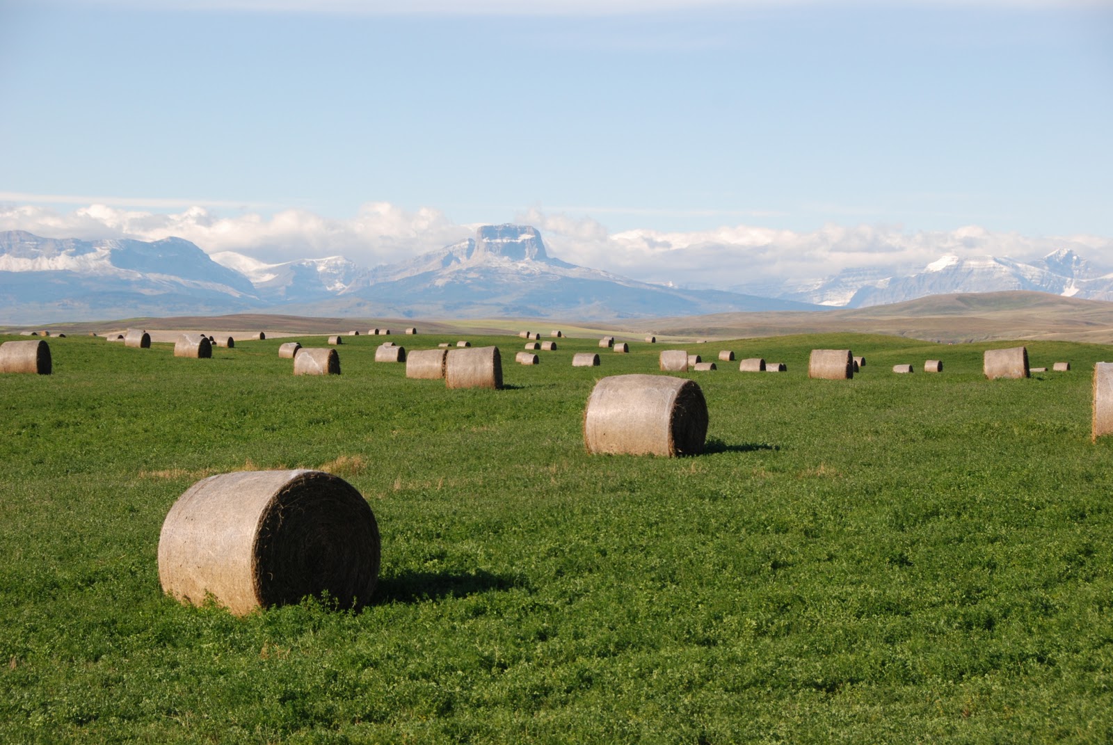
 Time to leave the shelter of Calgary and face the open road and whatever the weather would throw at us now that we were dried out and fuelled to go. First stop was Head-Smashed-In Buffalo Jump - a UNESCO World Heritage site where the ancient method of hunting buffalo by herding them for miles and then funneling them driving them over very specific cliffs areas. The Blackfoot first nations people (the Plains Indians of this area) hunted this way for nearly 6000 years. The exhibit centre is pretty cool describing the pre-hunt ceremony, the herding process and the jump with interesting archeological evidence. There are also walks around the area of the cliffs and the kill site, though nothing much to see now apart from cliffs that once were originally 20m high are now, after thousands of years of buffalo bone deposits, only 10m high.

 It seemed to keep on raining when we got to Calgary. We didn't care: we were DRY and WARM for the first time in what felt like a loooong time. Heaven! It was great to stay with friends Robb and Nat and their two kids, Abby and Maggie.... not to mention, the fabulous warm, dry roof over our heads! We spent some goofy times catching up with friends Jeff and Alana, and Sean and Emma too. We were reluctant to leave the warmth and comfort, so poor Robb and Nat had to put up with us for another day!
  The next four days we spent at beautiful Lake O’Hara.
 The campground was like a little community, with communal cooking shelters/warming huts and a big fire pit where we could all gather when it wasn’t raining. The hiking around the alpine circuits was amazing in spite of the rain. The mist and low-lying clouds added to the atmosphere, and once they lifted, the colours were more vibrant, if anything. The first larches were turning gold too. For those of you who don't know, larches are unusual trees because they are the only pine-needle tree that will change colour in autumn and lose its needles.
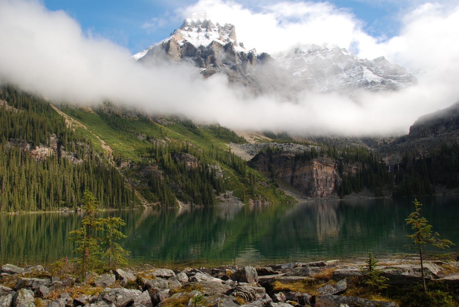

 On the evenings that it didn’t rain, we sat around the group fire pit and had great laughs and made smores (again generously donated by new friends who had left that day). I will have to explain smores as they are a very north American thing and we don’t 'do' them in England. They are basically a sandwich that you make around the campfire made with a freshly melted-on-the fire marshmallow with a square of (unmelted) chocolate and placed between 2 graham crackers (biscuits). They can only be eaten whole so you have to cram them in your mouth in one go, and if it's done correctly, the chocolate should melt from the heat of the marshmallow.

 The last couple of days, were somewhat chore days. Laundry, groceries, camp clean-up etc, so we had a late start back down the Icefields Parkway. As it is getting later in the season, a lot of the campsites have closed for the winter, so we were pleasantly surprised when we came across Rampart Creek campground, and it was still open. We had a really nice site backing onto the light blue creek, and chilled out with a glass of wine and backgammon at the river. We have been eating some great meals generally at our campsites, and tonight was no exception. Full bellies to sleep, and yet another night of rain – what is up with the weather!!
 We spent another couple of days in Jasper. We really like the feel of this cute town and would like to come back and explore a little more sometime. There are some great outdoor opportunities in Jasper, including Mt Robson – the highest mountain in Canada. We did another hike today, but not to the top of Robson or anything. It was at Mt Edith Cavell, named after the English nurse that helped many POW’s escape during WW1. I had no idea what to expect of this area, but was pleasantly surprised by the beauty of the glaciers and lake at the base. There was a massive hanging glacier above the lake called Angel Glacier because it had wings. The entire time we were in the area, you could hear the glacier calving and large chunks of ice falling down the cliffs. At the lake itself, the water was an incredible greeny turquoise colour and was full of ‘icebergs’ floating around in the lake. Once again, we did a 3 hour hike up past the moraines and the tourists, passing many little pikas scurrying around getting their winter nests in order. The view from the top of the hike was very serene. Looking down on the beautiful icebergs and lake was quite peaceful. We spent another couple of days in Jasper. We really like the feel of this cute town and would like to come back and explore a little more sometime. There are some great outdoor opportunities in Jasper, including Mt Robson – the highest mountain in Canada. We did another hike today, but not to the top of Robson or anything. It was at Mt Edith Cavell, named after the English nurse that helped many POW’s escape during WW1. I had no idea what to expect of this area, but was pleasantly surprised by the beauty of the glaciers and lake at the base. There was a massive hanging glacier above the lake called Angel Glacier because it had wings. The entire time we were in the area, you could hear the glacier calving and large chunks of ice falling down the cliffs. At the lake itself, the water was an incredible greeny turquoise colour and was full of ‘icebergs’ floating around in the lake. Once again, we did a 3 hour hike up past the moraines and the tourists, passing many little pikas scurrying around getting their winter nests in order. The view from the top of the hike was very serene. Looking down on the beautiful icebergs and lake was quite peaceful.   After the hike, to pick up the pace, I decided to get my bike off the roof and ride the 13km road all downhill to get the adrenaline flowing – FUN but also a little wet! Earlier that day, we had moved campsites, and instead of taking our tent down and deflating the mattress, we had carried the entire ’mobile home’ to the new site which seemed like miles away. To give you an idea of the magnitude of the 780 site campground, we had a couple of visitors that night that saw our lantern on and approached us. Dutch couple Ditmar and Frederik, could not find their way back to their rented RV, as they had gone out earlier for a drink and did not have a map or flashlight with them. We immediately were willing to help them find their way back, but not before sitting down for a glass of wine with us!! We were then rewarded handsomely for successfully navigating them home, with a few glasses of single malt whiskey which is Michelle’s favourite! We had some fun laughs with them, before navigating our way back home for a relatively warm and dry night! *Stub To see more Alberta photos, click here |
 We woke up to even more snow on the next morning. Packing up the WET tent again, and heading on our way, we continued North on the Parkway. Stunning scenery awaited us at every turn, along with some wildlife sightings (mountain sheep, mountain goats, elk, deer). We made stops at most viewpoints, but took some more time at Athabasca Falls. A few too many tourists, but what do you expect on the Labour Day weekend! The opaque blue water pouring out the back end of the canyon looked freezing and we felt cold just watching the white water rafting trip start. The staircases around the falls we really neat as they were built through dried up river channels from the falls.
 We had lunch at a nice lake in cute little Jasper, a beautiful little place that looks like a hub for outdoor adventures. Since we hadn’t showered in probably a week (hey – we are staying in primitive campsites) we cruised further north to Miette hot springs and after a rinse, we spent a couple of hours in the outdoor pools, with the rain coming down around us. The even better part was…… you guessed it, we got to shower after! Fresh and clean for another week! Back to the rain at Pocahontas campsite - we have become accustomed to holing up in our tent playing backgammon and cards at night.
 A short drive back down the valley brings us to Maligne Canyon, the place where the underground rivers come back above ground. We loved this canyon and took a long walk up and down the length of the canyon. At some points, the canyon was 50m deep, but probably only about 5m wide max. Super steep walls, very colourful green mosses and light blue waters filled with glacial sediment. Pretty impressive, and a highlight of the day.


 Martin can’t believe that he has lived in BC on and off since 1994, and never traveled the Icefields Parkway – probably one of the most scenic drives in the world. He had been to Lake Louise and Jasper (towns at the top and bottom of the Parkway) but has never done the 230km (160 miles) Icefields bit between them until now. For me, this will be my second time exploring this beautiful and interesting place.
 A wet, soggy start was a sign of things to come for the next few weeks. When the sun finally came out we screeched to a halt and draped a thankfully, quiet picnic area with our tarps, groundsheets and tent. And Bow Lake was a great scenic spot for lunch too!

 What to do on our second day….. how about a nice hike in the Rockies. (A note on translation for you non-Canadians here: a 'hike' is a walk in the wilderness, not a lift from the side of the road!) After sorting our gear, we got our day packs sorted and headed out for famous Moraine Lake, along with what seemed about fifty thousand others on the Saturday of Labour Day long weekend. If anyone has been to Moraine Lake, they know it is a beautiful sight, but FAR too many people. But, as soon as you start hiking, you lose about 90% of the tourists and get some solitude.
